Blog
Why we must thank a Scot for the accuracy of British maps
18th April 2023
The first ever trig point was put to use on this day in 1936, as Ordnance Survey engineers started work on a series of more accurate maps of Britain. The point was in a field in Northamptonshire but, if not for a Scot, the whole network of trig points might never have been built at all.
Malcolm Neynoe MacLeod
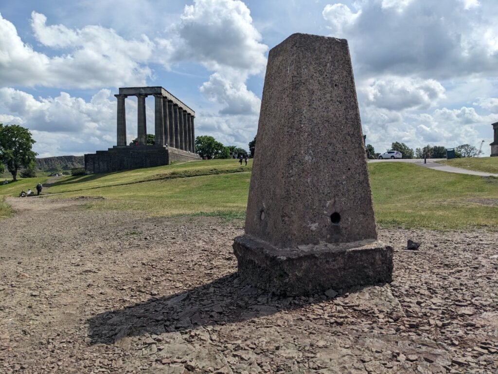
Malcolm MacLeod, who was both born and died in Edinburgh, and served in the Second Boer War and First World War, was director general of the Ordnance Survey between 1935 and 1943, and in that role would have overseen the construction of around 6500 concrete pillars – or trig points – across the country as part of a ‘retriangulation’ of Britain. The highest trig point is at the summit of Ben Nevis.
The pillars were constructed on high points and used to measure the angles between different points. The results helped to accurate plot the trig points’ locations and, in the process, establish a new surveying network.
This replaced the existing network, based on the Principal Triangulation of Great Britain, which had been established in the eighteenth century, but become increasingly inaccurate due to shifts in the landscape.
The project was a major undertaking that employed thousands of surveyors and had a significant impact on the accuracy of maps and surveying in the UK. The new surveying network has been used to create all of the Ordnance Survey maps that have been produced since the 1960s, and it has also been used for a variety of other purposes, such as engineering and construction.
Benefits of the retriangulation of Great Britain
The retriangulation is also a reminder of the importance of accurate surveying, which is essential for a wide range of activities, from mapmaking to engineering. It has resulted in:
- More accurate maps: The retriangulation of Great Britain led to the creation of more accurate maps, which are essential for a variety of purposes, such as navigation, planning, and emergency response.
- Improved surveying: The new surveying network that was created through the retriangulation has improved the accuracy of surveying in the UK, which is important for a variety of activities, such as engineering and construction.
- Increased knowledge of the Earth: The retriangulation of Great Britain also led to an increased understanding of the Earth’s crust and its movements. This information is valuable for a variety of purposes, such as planning for natural disasters and managing natural resources.
The retriangulation of Great Britain was a major achievement that has had a significant impact on the UK, the benefits of which are still being felt to this day.